
SERVICES

Construction and infrastructure monitoring.
Drones can used to document your projects progress over time.
PerryAir can conduct flights daily, weekly, or monthly depending on your need.
Drones are a safe, efficient way to monitor construction progress and ensure your project is completed on time.
3D modelling.
Drones can be used to create 3D models and conduct volumetric surveys. This process is often quicker and less expensive than traditional surveys. Reduce site downtime, increase safety, and save money by implementing drone imagery into your aggregate site or landfill.
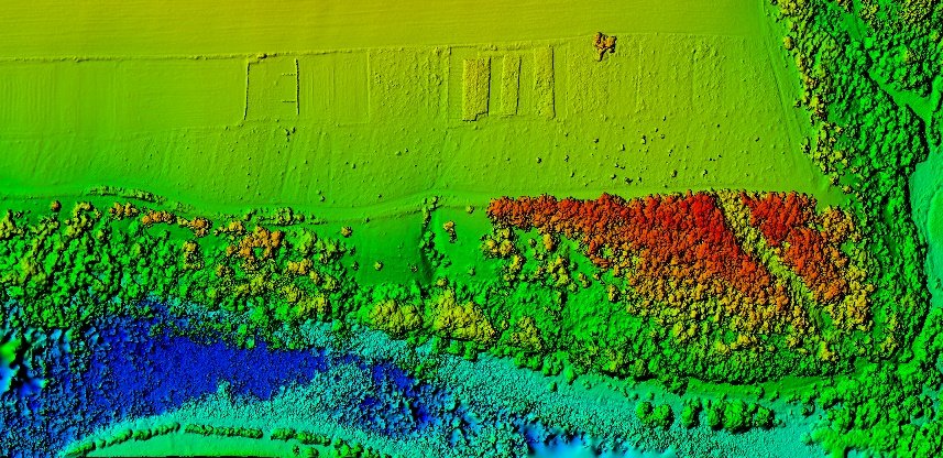
3D modelling.
Drones can be used to create 3D models and conduct volumetric surveys. This process is often
quicker and less expensive than traditional surveys. Reduce site downtime, increase safety, and save
money by implementing drone imagery into your aggregate site or landfill.

Powerline inspections.
Drones are extremely useful for more than one reason in managing powerline corridors. Drones can be used to conduct vegetation assessments, pinpointing vegetation in areas that may pose a problem before they arise.
Drones can be equipped to collect thermal imagery. We can assess areas that need to be repaired before they fail, and before people lose power. By implementing thermal scanning and a progressive maintenance regimen companies can reduce costs and the number of power failures.
Choose PerryAir for your thermal scans, we have experience successfully using thermal imagery.
Wildfire hotspot mapping.
PerryAir’s pilots have a 100% success rate of wildfire hotspot mapping missions. With thermal imagery we can pinpoint areas with buried hotspots. With the maps and coordinates we produce we can ensure that hotspots are put out and the chance for re-ignition is kept to a minimum. PerryAir offers its
wildfire hotspot mapping services internationally.

Wildfire hotspot mapping.
PerryAir’s pilots have a 100% success rate of wildfire hotspot mapping missions. With thermal imagery we can pinpoint areas with buried hotspots. With the maps and coordinates we produce we can ensure that hotspots are put out and the chance for re-ignition is kept to a minimum. PerryAir offers its
wildfire hotspot mapping services internationally.